Loading Fixed Format Map Data
After preparing map data for loading into the Trapeze4 map database, you can load data in fixed formats.
You can load the data in the following fixed formats:
- TIGER/Line Record Type 1, Record Type 2 and Record Type 3
- Ordnance Survey Integrated Transport Network (OS Mastermap ITN) Layer
When you load fixed format data, you must specify which data files to load. Because fixed format data file structures are standardized, the system knows which data from the files to save in which database tables and fields.
When loading data into the Trapeze4 map database, you can specify database tables where you
want to preserve existing data. For example, if your transit site has created polygons in
the map database, you can specify that you want to preserve data in the polygon database
table.
Note: The mmsMap.dbd file defines all tables and fields in the Trapeze4 map
database.
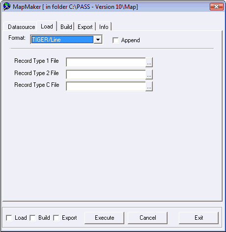
- Optional:
If you are loading data in Tiger/Line format, for each of the following fields, click
the ellipsis (...) button and select map data files.
- Record Type 1 File – File with .bw1 extension (or .f41 in earlier versions) that contains segment end-point descriptions and attributes.
- Record Type 2 File – File with .bw2 extension (or .f42 in earlier versions) that contains the segment shape point descriptions.
- Record Type C File – File with bwc extension that contains the lookup table for
place codes for states, counties, cities, and minor civil divisions referenced in the
Record Type 1 file.